The embedded player loads automatically on the published site. In local previews, YouTube may block playback.
Selected documentation of my visual application and animation work for The Atlas of Maritime Buddhism / Buddhist Maritime Silk Road, an immersive cultural-heritage project presented across 360 visualization environments in Hong Kong and Taiwan.
Visual application development, animation, immersive content production, 360 visual systems
Collaborators
Professor Jeffrey Shaw, Sarah Kenderdine, Venerable Ru Chang, Lewis R. Lancaster
Institutions
City University of Hong Kong / ACIM HKBU Visualization Research Centre EPFL Laboratory for Experimental Museology Fo Guang Shan Buddha Museum
Jeffrey Shaw's The Atlas of Maritime Buddhism is an immersive cultural-heritage project that maps the maritime transmission of Buddhism across Asia through panoramic imagery, spatial media and interactive navigation. Publicly documented by the HKBU Visualization Research Centre, the project brings together stereoscopic panoramas, video, temple architecture, ritual imagery and geographic routes associated with Buddhist sites in India, Sri Lanka, Cambodia, China, Indonesia, Myanmar and Thailand. Alejandro Rodríguez contributed between 2021 and 2025 on the visual application and animation layer: navigation behaviours, visual transitions, panorama presentation logic and immersive 360° content production. This page documents that selected contribution within a larger collaborative and institutional framework.
A major public presentation of this research was The Buddhist Maritime Silk Road, developed for the Fo Guang Shan Buddha Museum in Kaohsiung, Taiwan, where the Atlas became part of a new media exhibition on the movement of Buddhist teachings, architecture, ritual and art through maritime routes of trade and pilgrimage. The importance of this work lies in the encounter between archive and atmosphere. The project uses advanced visualization systems not only to display information, but to create a field of attention around cultural memory. The viewer is surrounded by routes, temples, images, ceremonies and fragments of sacred architecture; history appears less as a linear timeline than as a navigable space of correspondences.
Images
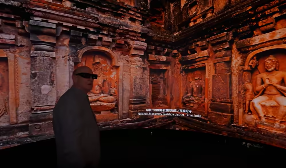
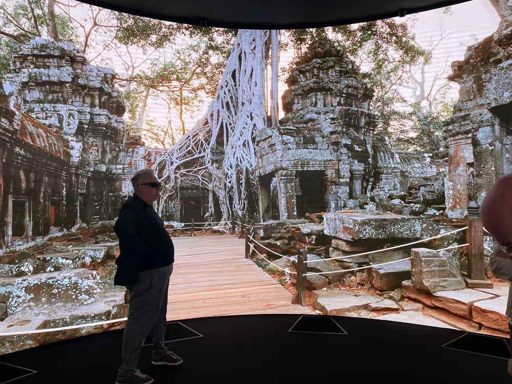
Professor Jeffrey Shaw guiding a walkthrough inside a Nalanda Monastery panorama, presented inside the cylindrical installation as part of the Atlas journey.
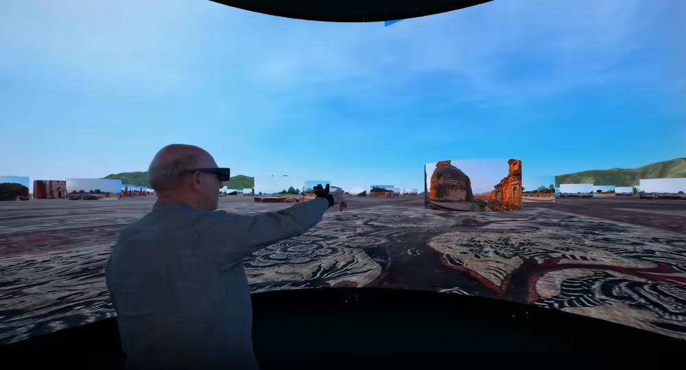
Professor Jeffrey Shaw navigating the Atlas through a spatial field of panorama cylinders, turning the archive into an explorable landscape.
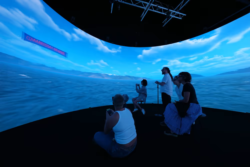
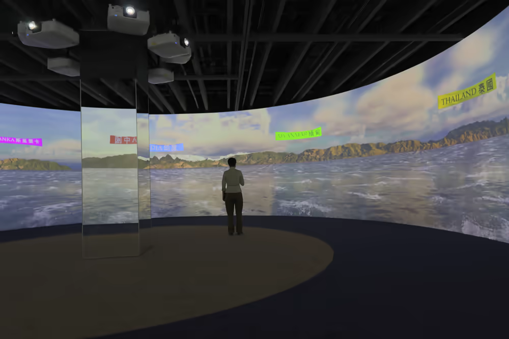
Maritime navigation environment with country labels and Buddhist sea route markers on the cylindrical display.
The Atlas begins from an animated maritime space, where countries appear as navigable destinations along Buddhist sea routes.
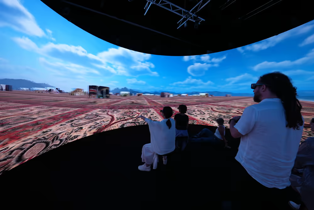
The interactive world presents panoramic sites as navigable cylinders distributed across a continuous terrain.
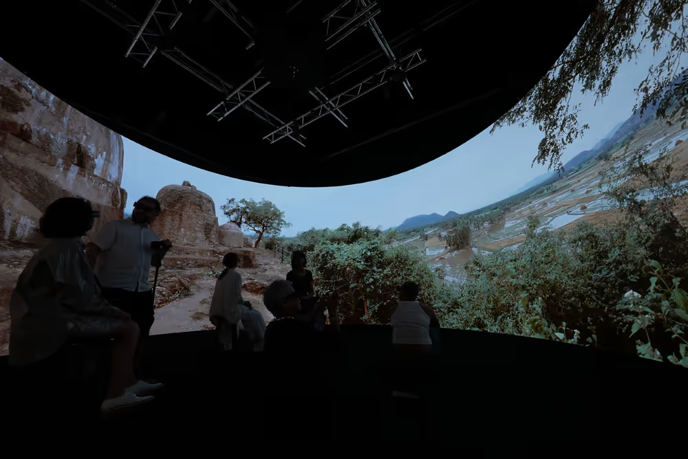
Project walkthrough inside the 360 cylindrical display, with a temple panorama presented at architectural scale.
Taiwan presentation of the Atlas at Fo Guang Shan Buddha Museum, with the maritime navigation environment and country labels visible across the panoramic screen.
The panoramic archive moves between maritime geography and temple interiors, bringing archaeological sites into an embodied display.
The Atlas connects Buddhist sites to their surrounding landscapes, extending the experience beyond monuments and interiors.
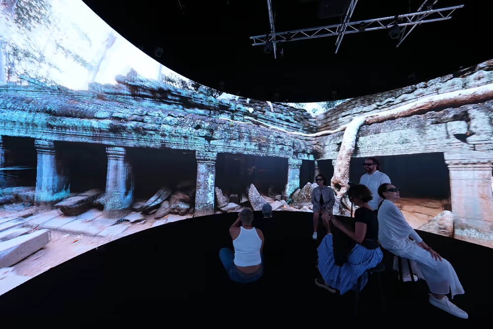
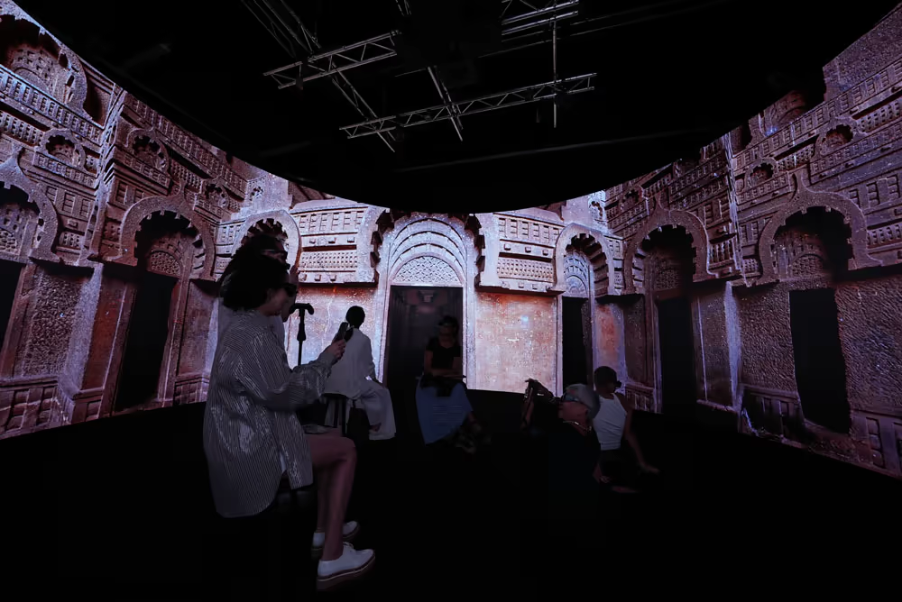
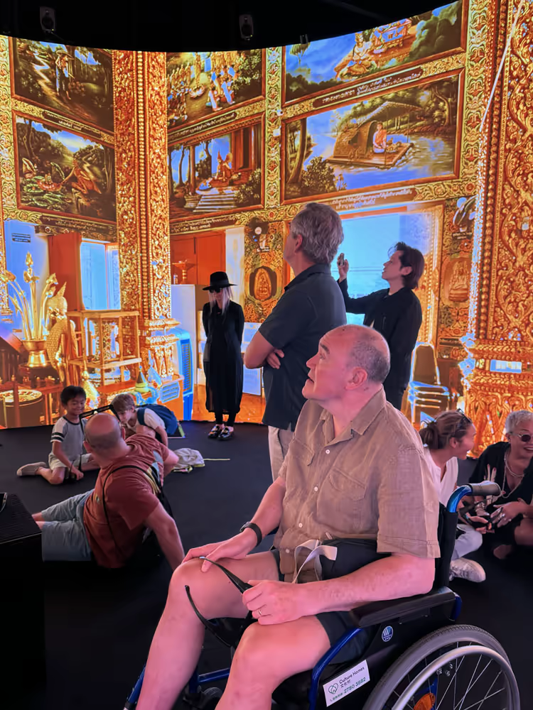
Audience demonstration in nVis, where panoramic temple imagery becomes a shared spatial experience.
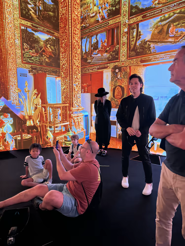
Immersive temple interior presented in the cylindrical display, combining architectural detail, ornament and shared viewing.
Public viewing inside the immersive Atlas environment, where temple interiors, ornament and audience movement share the same space.
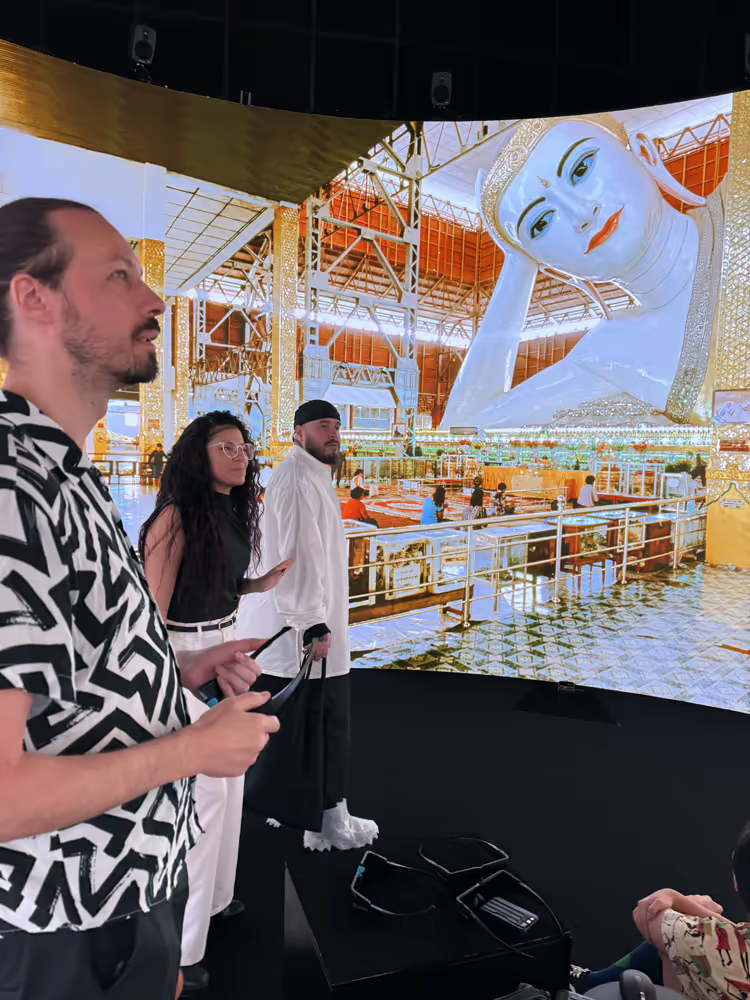
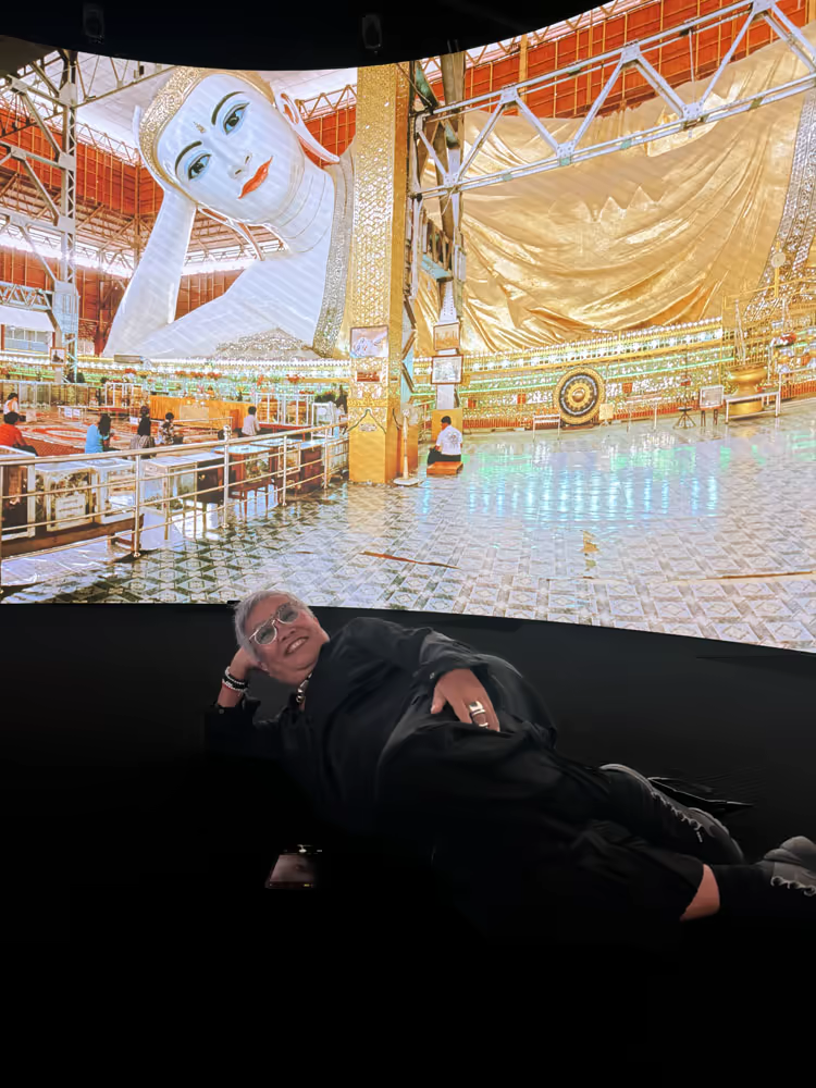
Monumental Buddhist imagery becomes an inhabitable visual field inside the immersive display.
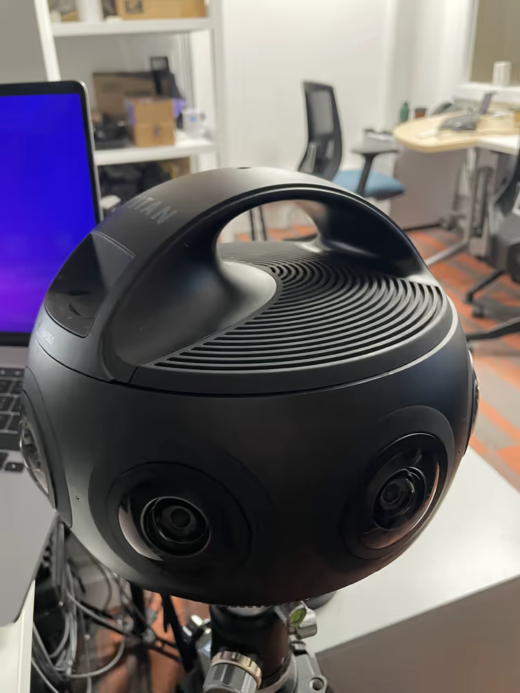
High-resolution 360 capture equipment used in the project panoramic imaging and production process.
Core project
The Atlas of Maritime Buddhism / Buddhist Maritime Silk Road